Studying the tectonics of Mongolia
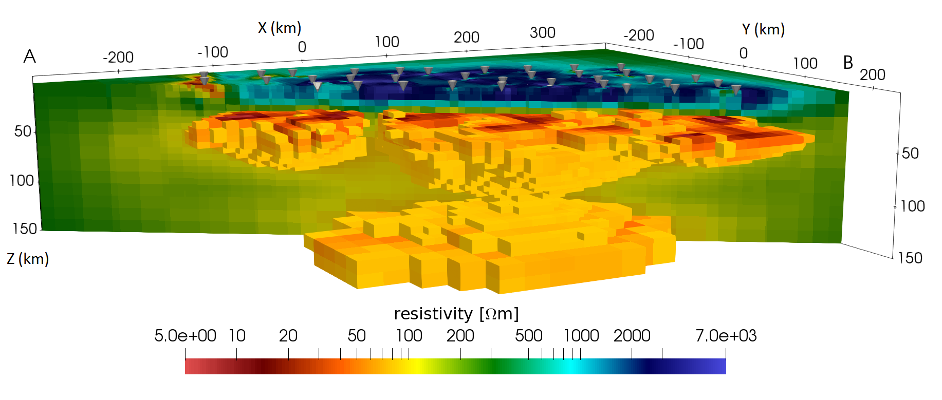
This project aims at understanding the uplift processes of the Hangai Mountains in west-central Mongolia. Due to its intracontinental location far away from active plate boundaries, collisional plate tectonics (as observed e. g. in the Alps or the Himalayas) can not explain the uplift of this mountain range. Instead, melting processes at the crust-mantle boundary are thought to be responsible for the uplift. Geological and geophysical studies in the past found evidence for volcanic activity in the Cenozoic (30 mil. years ago), as well as the presence of melt below the Hangai Dome, but detailed geophysical models are still missing. Since the presence of melt strongly affects the bulk electrical resistivity in the subsurface, a three-dimensional image of the resistivity, obtained by magnetotellurics, can be a key element to reveal the uplift processes.

In close collaboration with the Institute for Geophysics from University of Münster and the Institute of Astronomy and Geophysics from the Mongolian Academy of Sciences, the Earth and Planetary Magnetism group carried out three magnetotelluric field surveys during the years 2016-2018. Data were collected on 328 locations in the Hangai Mountains and surrounding regions. To image the electrical resistivity, we use a novel electromagnetic modeling and inversion code developed by Dr. Alexander Grayver. The resulting model will be the first 3-D model of the regional resistivity structure, resolving the Lithospere-Astenosphere boundary at a depth of approx. 120 km together with small and detailed structures close to the surface.